|
OUR
TECHNOLOGIES:
We use
100% digital land surveying equipments and data
processing techniques.
The land surveying equipments includes Differential
Global Positioning Systems, Electronic Total Stations,
Theodolites, Auto Levels etc.
The data processing techniques includes latest hardware
and softwares which includes:
HARDWARE:
Latest Pentium computers, Laptops, A0 size plotters,
Printers, scanning facilities etc.
SOFTWARE:
Latest operating systems, Latest versions of
AutoCAD from Autodesk, Autoplotter, Civilcad, CMS
IntelliCAD and GNSS Studio etc. to name a few.
GIS
GIS is a technology that is used to view and analyze
data from a geographic perspective. The technology is a
piece of an organization's overall information system
framework.
GIS links location to information (such as people to
addresses, buildings to parcels, or streets within a
network) and layers that information to give you a
better understanding of how it all interrelates. You
choose what layers to combine based on your purpose.
|
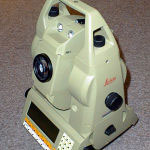 |
Instrument Survey
The traditional
approach, but using first-order reflectorless
instruments (REDM) or subsecond instruments for
monitoring and control. |
|
|
|
|
|
|
|
|
|
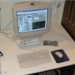 |
CAD Operations
All data from
Downland is processed through either AutoCad or
Microstation before being converted into the
end-user system format. |
|
